
Living in Europe and hiking the Swiss or Austrian Alps on the weekends is amazing. However, of all my hiking adventures, I think the hike to Skagway Powerplant was by far the most intriguing. From navigating a river for over 11 miles, crossing it 16 times, and stepping back in time with the remnants of electricity generators, this trek is truly unique. If you’re seeking the most unique hike in Colorado, then a hike to Skagway Powerplant should top your list.
History of the Skagway Powerplant
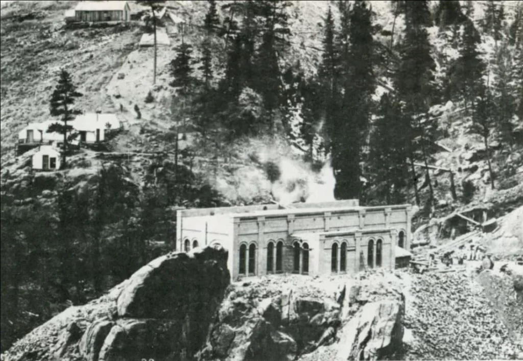
Before setting out on what I consider the most unique hike in Colorado, it’s worth delving into the history of the Skagway Powerplant. Originally commissioned in 1901, the Skagway Powerplant was built to supply electricity to the nearby town of Victor. In 1899, 500 men worked tirelessly to construct a dam in the canyon. For two years, they laid five miles of pipe to carry water from the reservoir with enough pressure to move five massive turbines at the powerplant. This setup provided power to Victor for over 60 years!
Pro tip: For an in-depth read on Skagway’s history, check out this post here!
However, in 1965, disaster struck. One day, rain began falling, and it continued for 15 straight days. The dam couldn’t hold the pressure, resulting in a five-foot-high wall of water that crashed through the valley. This flood obliterated the pipeline and caused significant damage to the powerplant. Although there were mentions of restoring the plant, the sheer difficulty of the task proved too great. As a result, the Skagway Powerplant was abandoned and all but forgotten—until adventurous hikers like us decided to rediscover its hidden past.
Embarking on the Skagway Powerplant Hike: A Unique Colorado Adventure
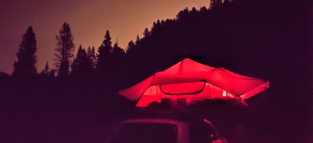
My rather impromptu hiking trip to Skagway began with an overnight stay under the stars in the San Isabel National Forest. COVID had closed nearly everything down in Colorado Springs, so Ciara and I turned to camping to pass the time.
One evening, I stumbled upon an article about an abandoned powerplant about an hour away. I suggested to Ciara that we explore this spot, turning it into a weekend camping trip, and she happily agreed. It would be our first camping trip together!
I’m happy to report that this one camping trip led to an amazing life journey with Ciara. We’ve literally travelled the world! For more fun reads, check out our Korean adventures, our European travels, or just more Colorado stories!
We spent the first half of the evening collecting firewood and roasting s’mores over a fire–this girl knows how to camp! We crawled into my rooftop tent around 11:00 p.m. and got a good night’s sleep for the next day’s adventures.
Waking to birds singing and a gentle morning breeze through the mountain pines was pure tranquility. Climbing out of the tent, Ciara stoked the coals from the fire to heat some breakfast burritos she had prepped the night before. With no idea how long our journey to the abandoned powerplant would take, we prepared our stomachs for what could be the last big meal for a while.
Jeeping to Skagway Reservoir
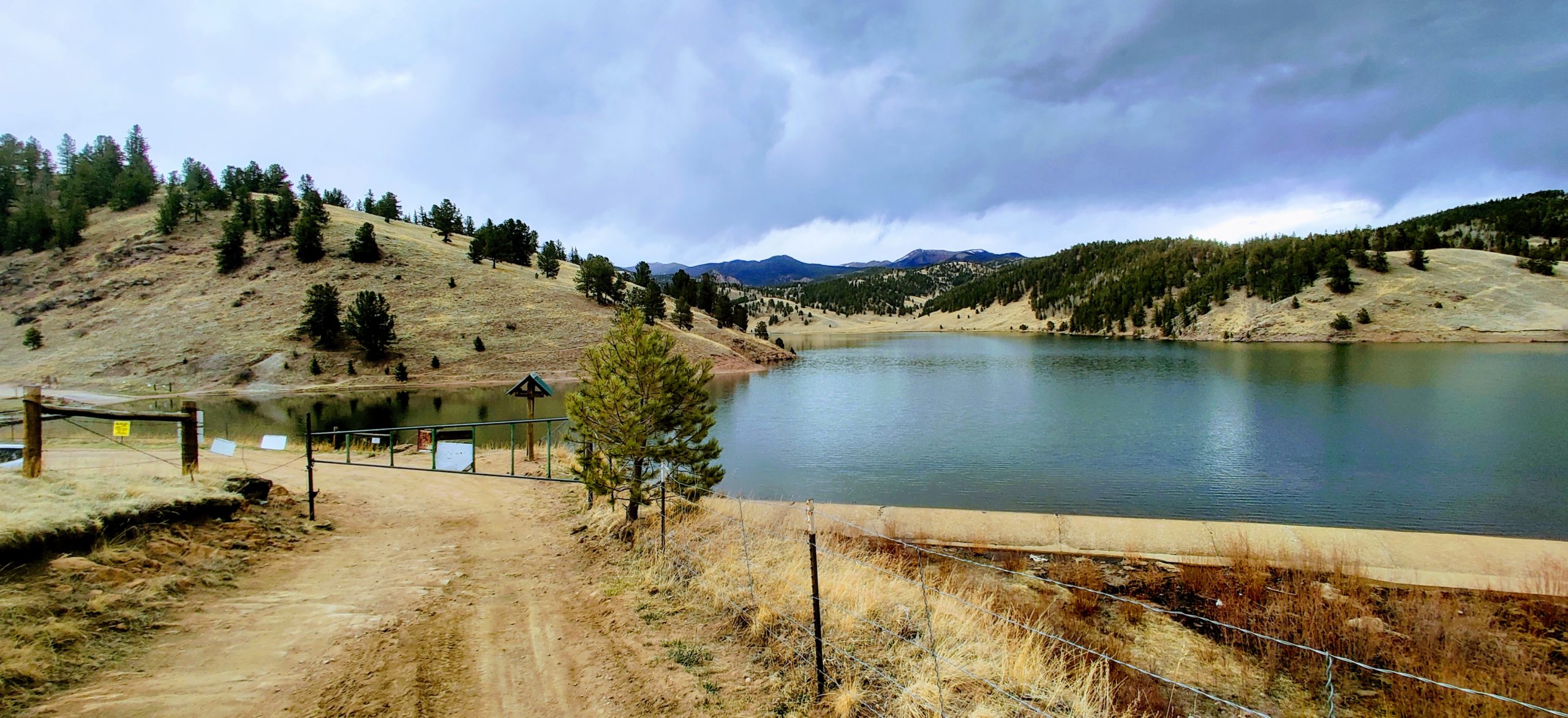
We did a little Jeeping to get back across the small stream we camped near, then it was off to Skagway Reservoir for what was likely the most unique hike in Colorado.
Winding through the forest roads in the Rockies, we passed through a series of tunnels created decades ago. Eventually, we came across a sign outlining the history of the road we were on—Gold Camp Road..
Gold Camp Road (as it’s now known) was established by the Utes (a Native American tribe) as a war trail. It became the Colorado Springs & Cripple Creek District Railroad in 1901 after gold was discovered in Cripple Creek.
Post WWI, the railroad company went out of business given another company’s competition. A wealthy man bought the failed railroad for pennies on the dollar, removed all the tracks, put toll booths in place, and opened a highway for transportation between Cripple Creek and Colorado Springs–the Corley Mountain Highway.
From 1926 to 1939, the highway made Corley a good deal of money as an awe-inspiring tourist attraction. When the permit for the highway expired, the company was forced to turn the road over to the federal government. The government dubbed the road Gold Camp Road in 1939 and allowed visitors to use the road free of charge.
…ok, history lesson over. Back to the hike!
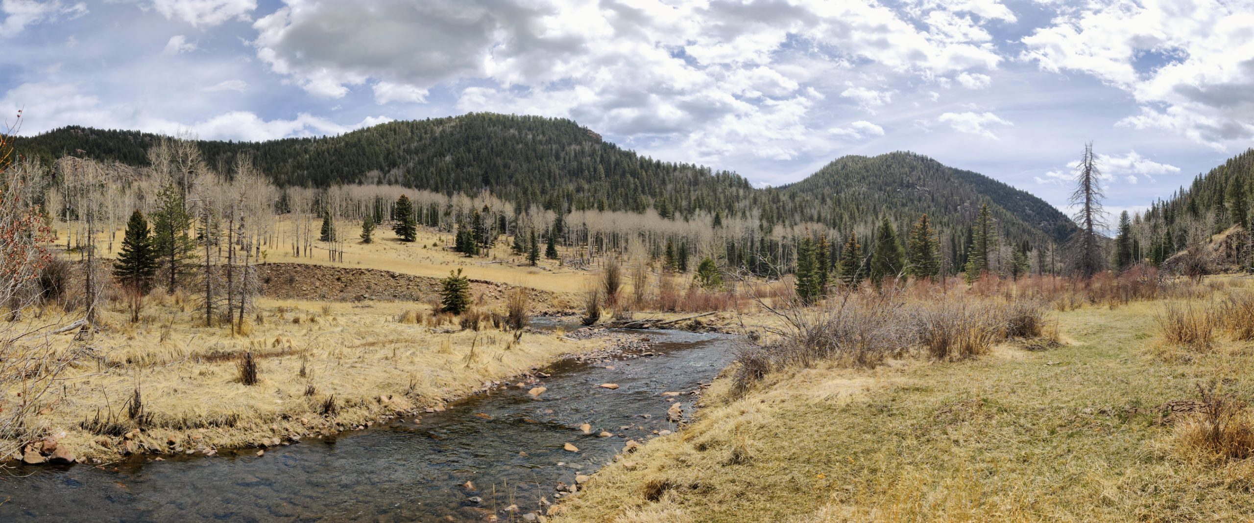
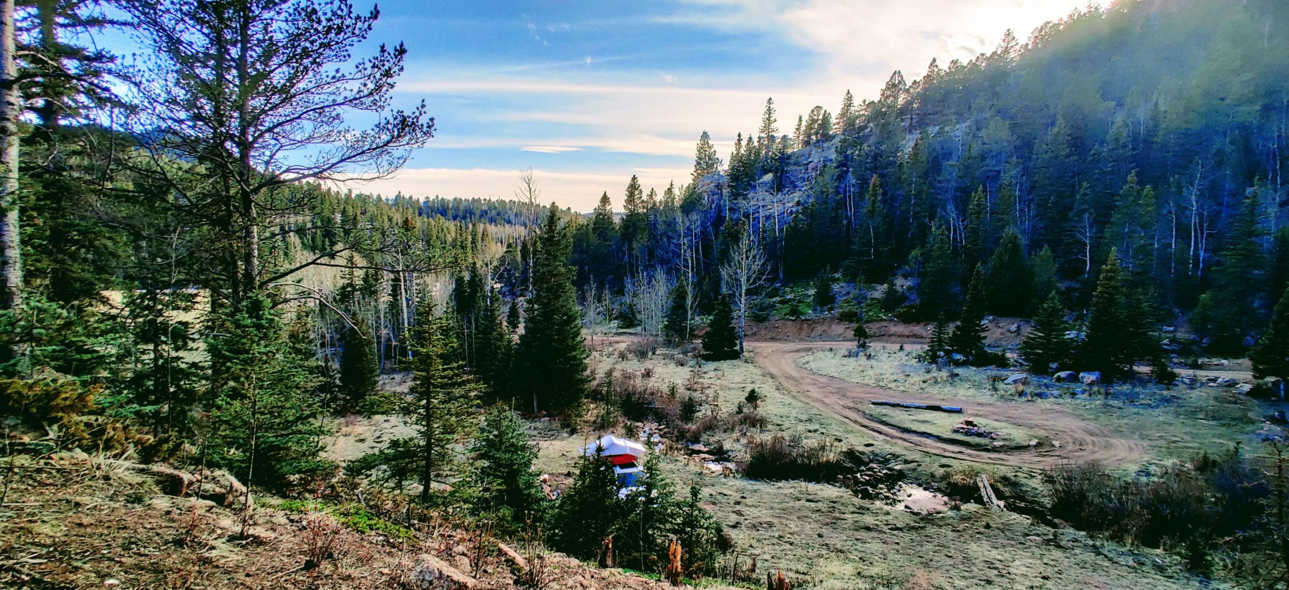
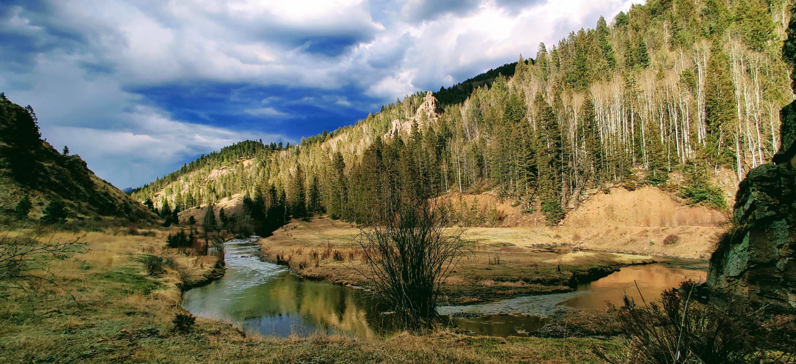
We parked at Skagway Reservoir and made our way south along West Beaver Creek for the beginning of our 11.4-mile round trip. The initial few miles of the hike are along pristine grassland in the mountains where the spillway would be for the Skagway Reservoir.
The initial few miles of the hike were along pristine grassland in the mountains where the spillway for the reservoir would be. We made good time, mistakenly thinking the entire hike would be this easy. That was definitely not the case.
Challenges and Triumps on the Trail
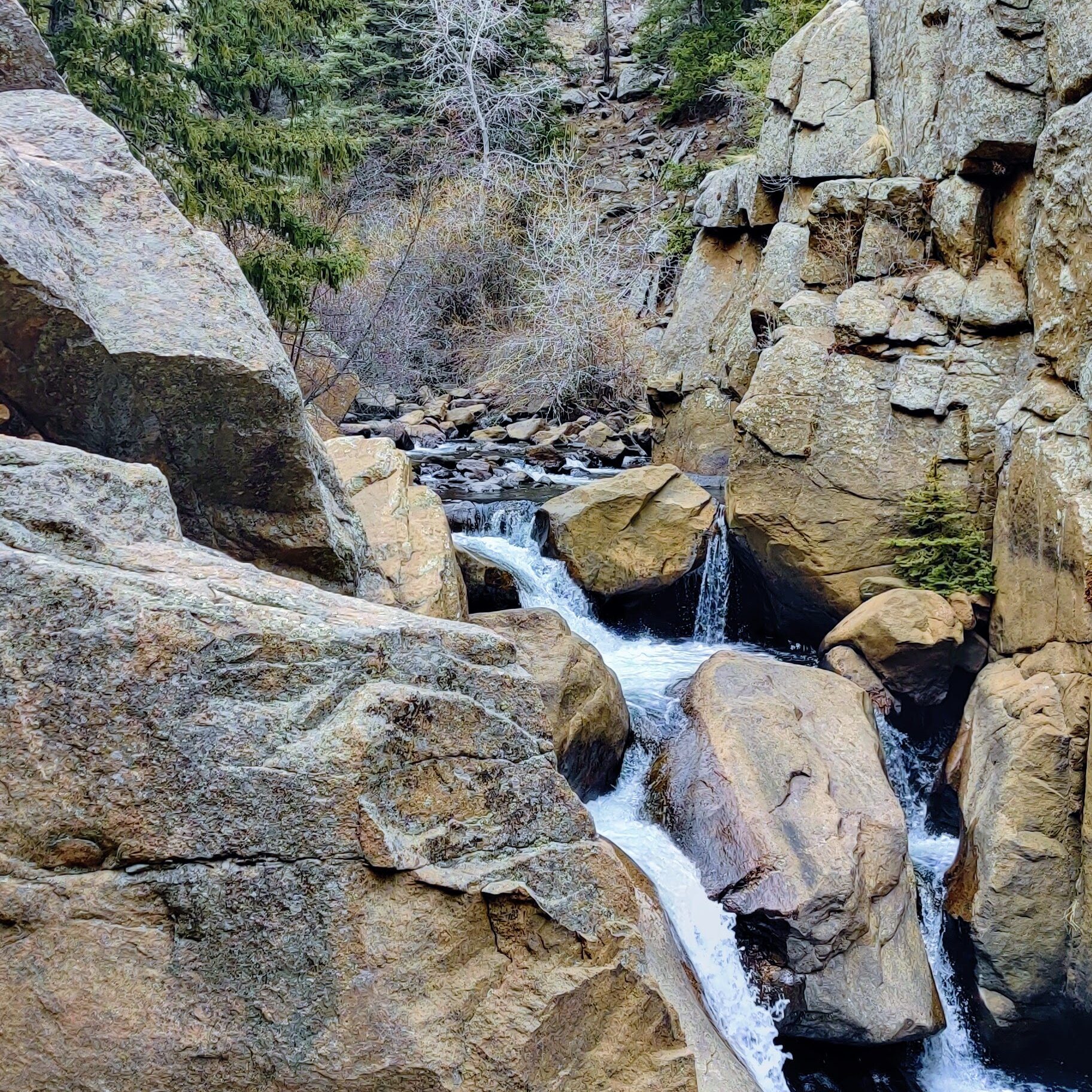
After a few miles, the trail quickly turned to rugged hiking and scrambling up and down steep grades and boulders. It ended up forcing us to cross the river eight times on the way to the powerplant. Ciara soon realized her Nikes weren’t the best for gripping the narrow logs placed to help hikers cross the river, but she persevered.
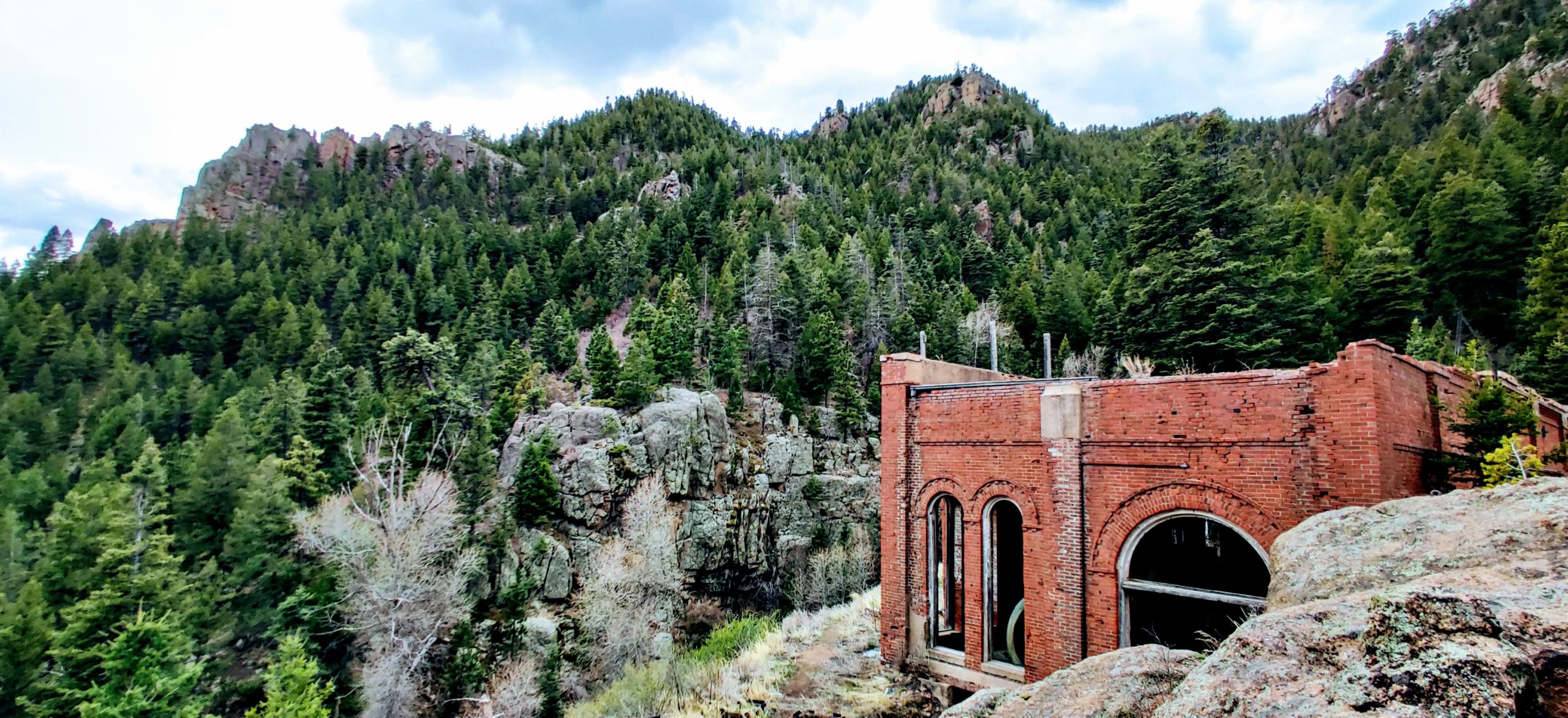
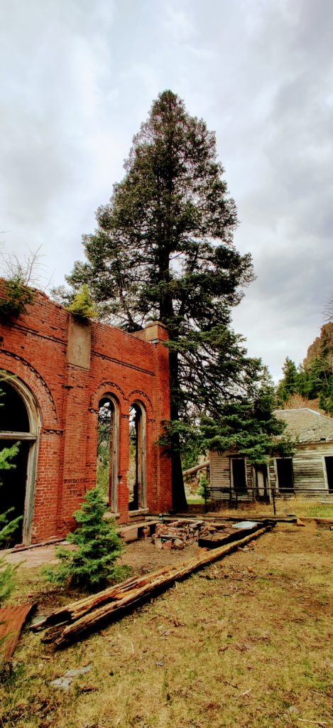
Successfully across the river all eight times and still in one piece, we paused at a clearing in the canyon and spotted an industrial brick building on top of a hill. We had made it!
The immediate sensation was one of eeriness and wonder.
How had this place stood the test of time?
How old was this place?
Did people live here or commute by foot or horseback?
What happened and where did everyone go?
Did they leave or are they buried in these hills?
We pressed on into the small village, hoping to find any clues to answer our many questions.
Exploring the Abandoned Skagway Powerplant on This Unique Colorado Hike
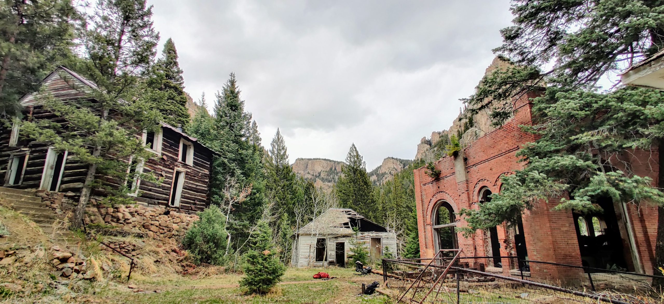
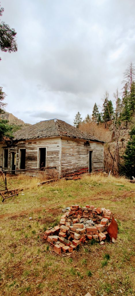
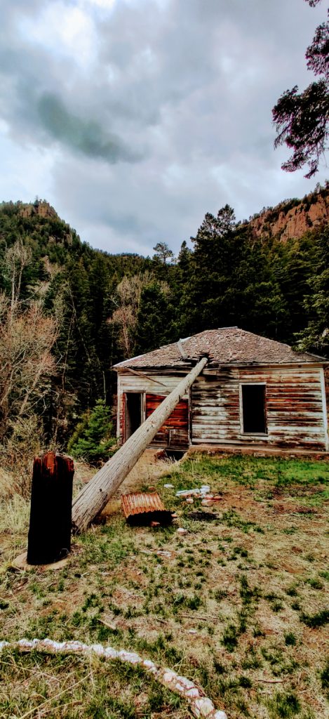
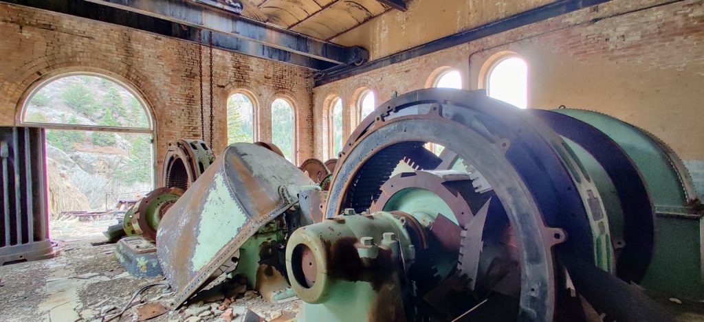
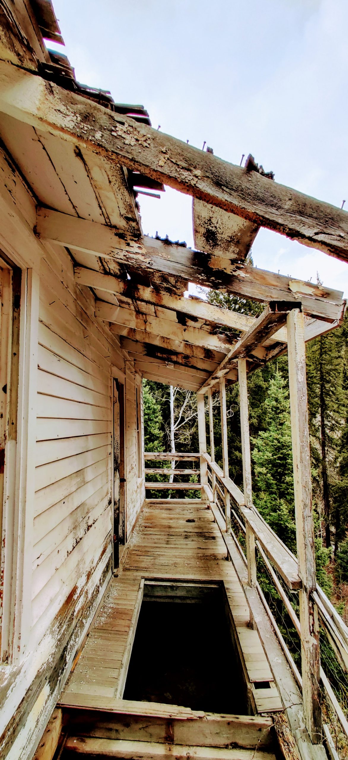
All the glass was broken and every floorboard creaked, causing us to tread lightly. The ceilings were so low that at 6’0″, I had to wonder if I would hit my head as I crossed through each doorway. The foundations of each building had all but given way to the shifting rocks beneath them.
In concert, each structure leaned toward the creek below us, some hundred feet down into the canyon. Some roofs remained intact, but others had been destroyed by the elements or by things falling on them.
This was by far the most unique hike I’d ever been on in Colorado.
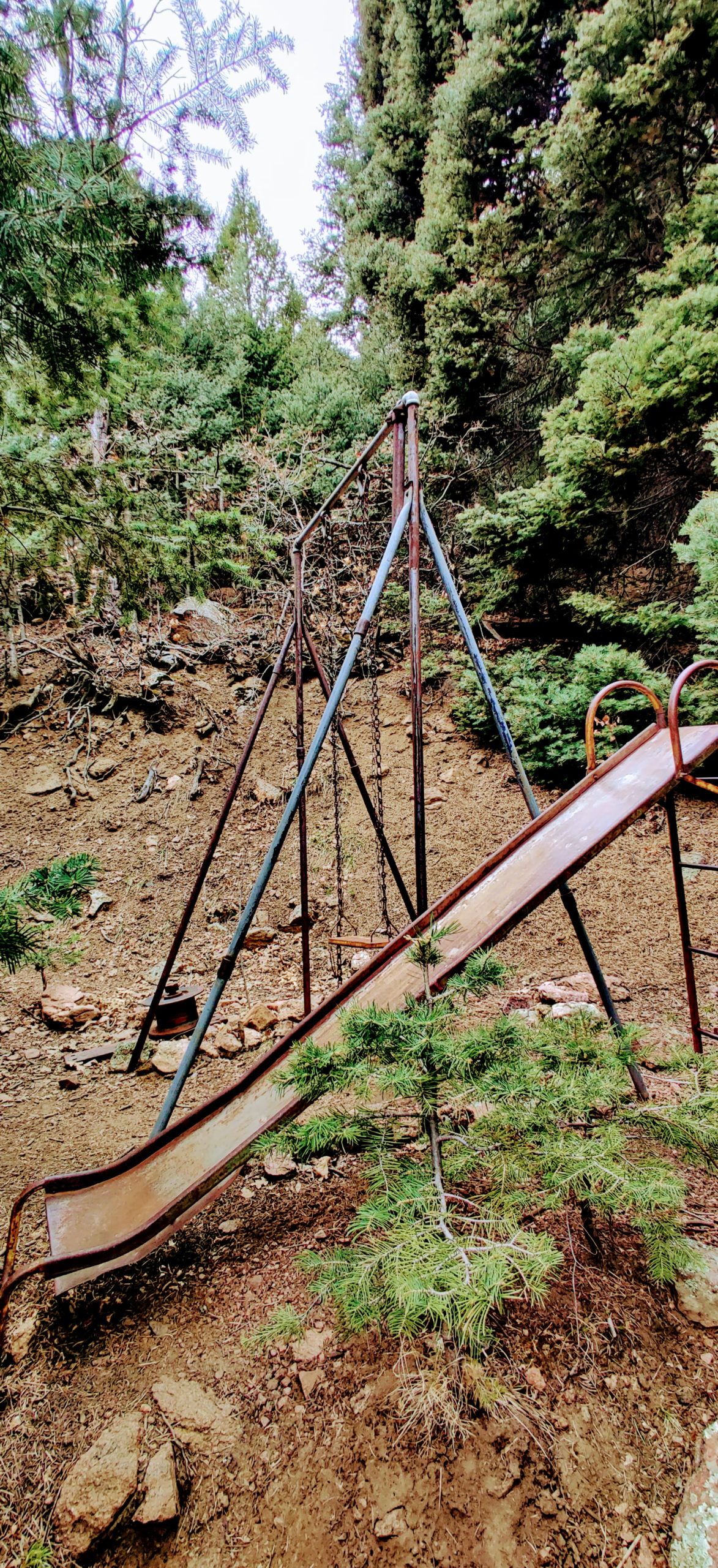
Most interesting was the sense of urgency you could feel with regards to everyone leaving all those years ago. This begged the question: did people leave or did something terrible happen? I hadn’t read the history on this place, only that it simply existed.
Children’s toys were still lying about, fences were still upright around the gardening areas, and all the heavy machinery needed to generate power was still in its original place. Ciara and I wandered through what was likely the main generation building and touched the rusted metal once used to generate power. Yet, we had no idea how the power was generated or where it was ultimately sent to.
Questions flooded our minds.
Resting and Reflecting
After thoroughly exploring each of the still-standing buildings, Ciara and I climbed a nearby rock for a well-deserved rest. We opened the backpack, pulled out our sandwiches, and rested in the grandness of history and determination. Five and a half miles in, we didn’t want to acknowledge that we still had the same distance to go back.
As we concocted stories about what we thought might have happened here, we decided that we would research the history of this ghost town to satisfy our curiosity once we got out of the canyon.
With one final gaze at the mysterious Skagway Powerplant, we tightened our laces and started back to the Jeep.
Just over five and a half miles and eight more river crossings later, we made it back to the Jeep. Instantly, the shoes came off, and fresh socks were put on. If you’ve done long hikes before, then you know the pleaseure of this feeling.
We pulled out of the Skagway Reservoir parking lot and made our way towards the town of Divide before ultimately heading back to Colorado Springs.
Preparing for the Most Unique Hike in Colorado
If you’re planning on making this unique hike in Colorado, be sure you are an experienced hiker with the appropriate gear. The 11.4 miles are not a walk in the park; rather, they involve crossing rivers, scrambling up and down large boulders, and potentially encountering mountain lions. Take care if you decide to endure this journey, and always remember to leave places like this a little better than you find them. For a full read of all the grandness that is Skagway Powerplant, I recommend reading this article here.
Embark on this unique hike in Colorado and discover the hidden history and breathtaking scenery for yourself.
Fun post, but the place is named “Skaguay” not “Skagway” though they are pronounced the same
Thankyou for the wonderful account. I won’t be doing the hike because i am 80, but now i dont need to. I haved fished the reservoir for 15 years and it is the best place Ive found in southern Colorado to catch bows averaging a foot. Since I gave my drift boat to my son last fall, i’ll tell where my favorite spot is; three years ago at the end of May, just after ice out, my friend and I caught 97 bows in two hours. So, paddle towards the inlet and on the right shore across from the beautiful cabin on the hill anchor 50 feet off shore and pick them up along the bank. You will be watched by a bald eagle and clacker geese. Put them all back so you can catch them next time. Lures: fly rod with a bloody butcher or bead head green wolly buger, #14 and open face, green pistol pete with a slow paused retrieve.