
Posts with photos of picturesque landscapes have been blowing up my social media feed for a few years now. Almost every time I check the descriptions, I see a hashtag for Switzerland, or at least geotags linked to this stunning country. Clearly the algorithm knows what I need or else it wouldn’t have suggested hiking Oeschinen Lake in Switzerland.
Living in Korea, I often dreamed of hiking these amazing locations. It wasn’t the influencer posts tha tdrew me to them, but the desire for tougher mountains than the mountains of Korea.
Korean mountains are tough, sure, but I’m from Colorado. And we have 14ers; lots of them. Growing up and then being stationed in Colorado for my first duty assignment was God-send for my soul. Every chance I got, I drove west into the Rockies to find a new trail or summit to conquer.
As John Muir would say, I was constantly headed into the mountains to lose my mind and find my soul.
A Dream Come True: Hiking Oeschinen Lake
Now that I live in Germany, only a few hours from Switzerland, my plan is to fill my phone gallery with what was once only social media posts.
After my recent experience in the Bavarian Alps, I was eager for more mountain hikes along this incredible range. So, I wasted no time planning a trip to Switzerland, specifically Oeschinen Lake. I pointed my Subaru south and headed out of town.
Destination: Oeschinen Lake (or Oeschinensee Lake)
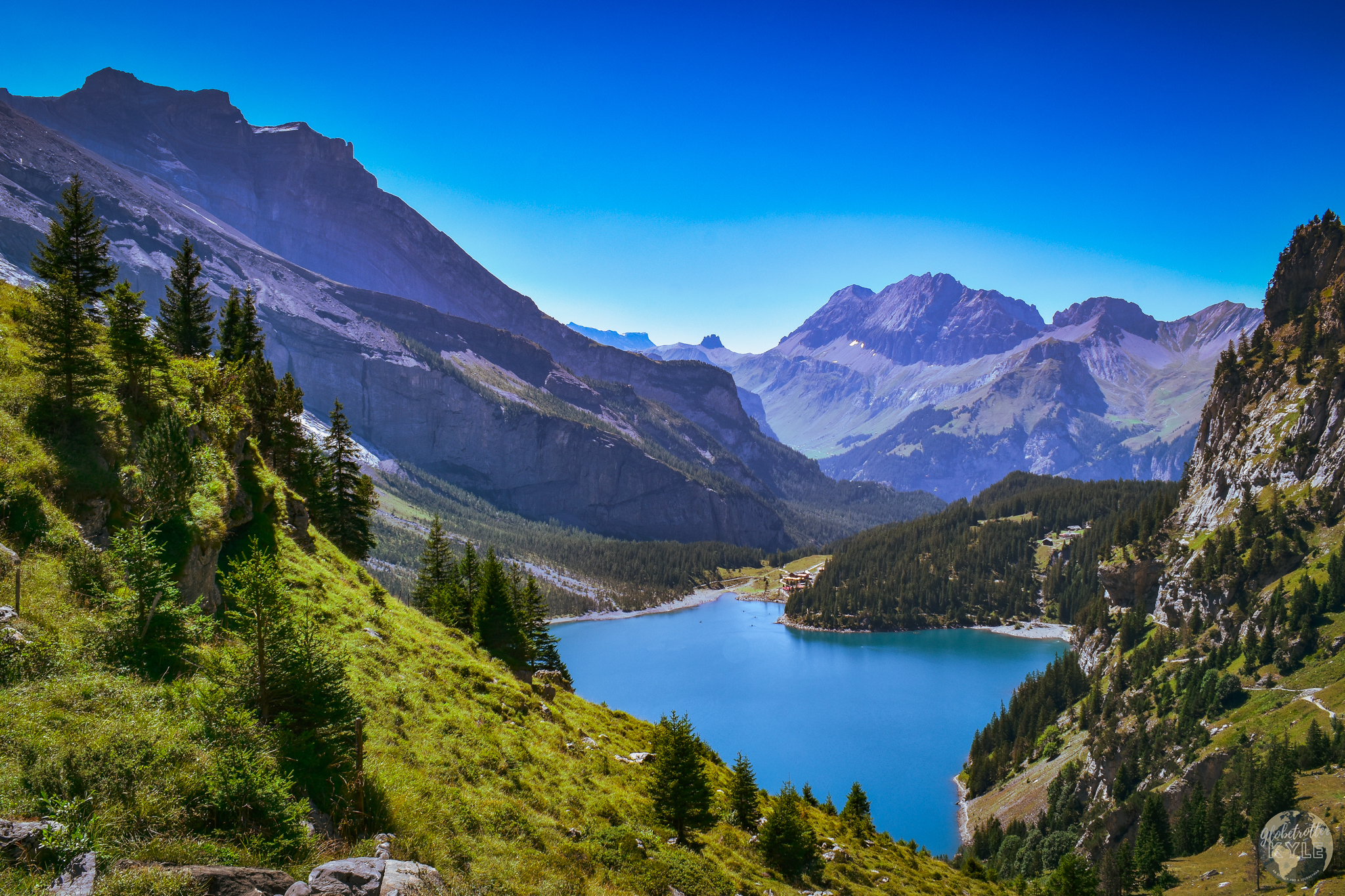
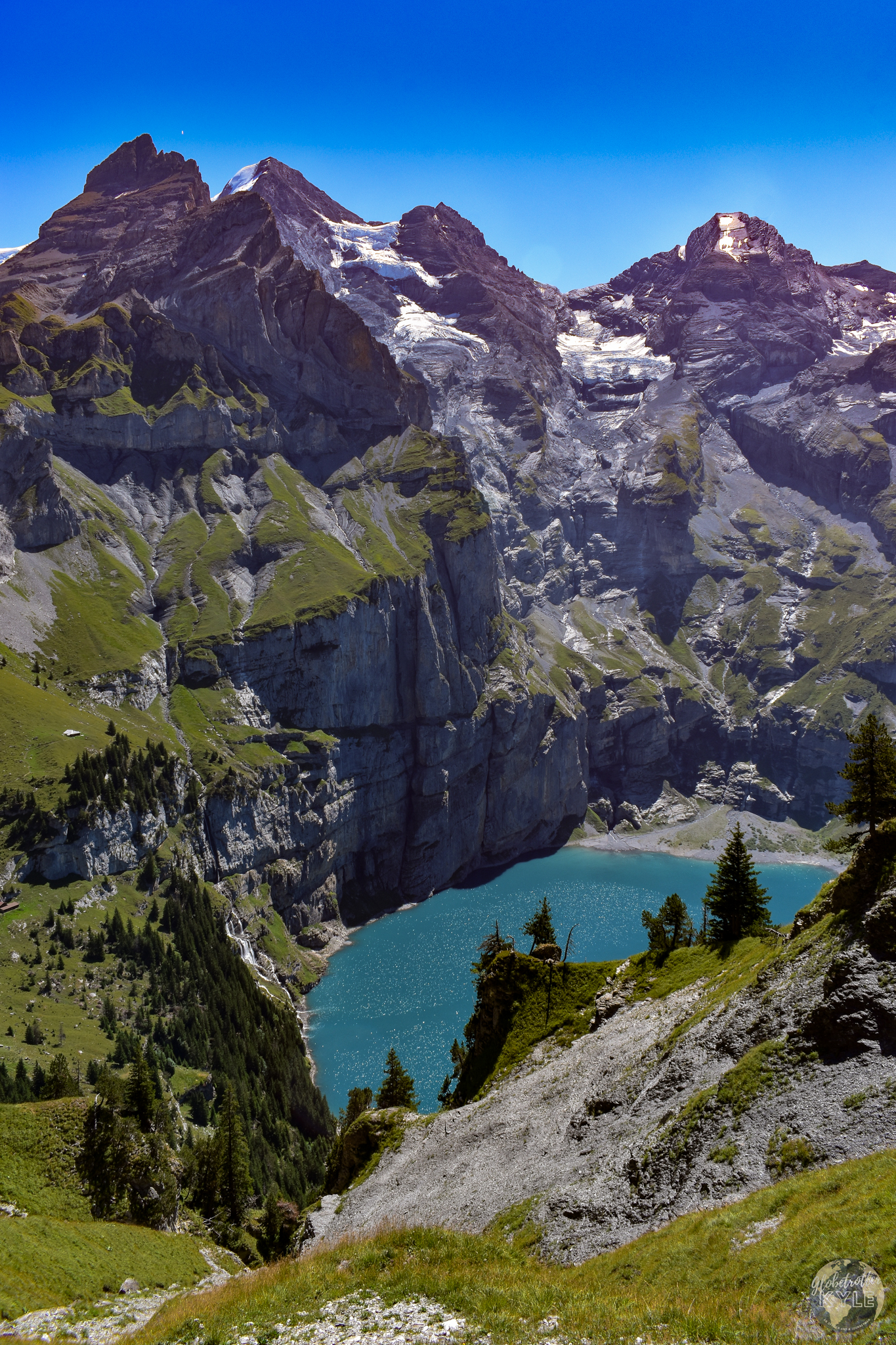
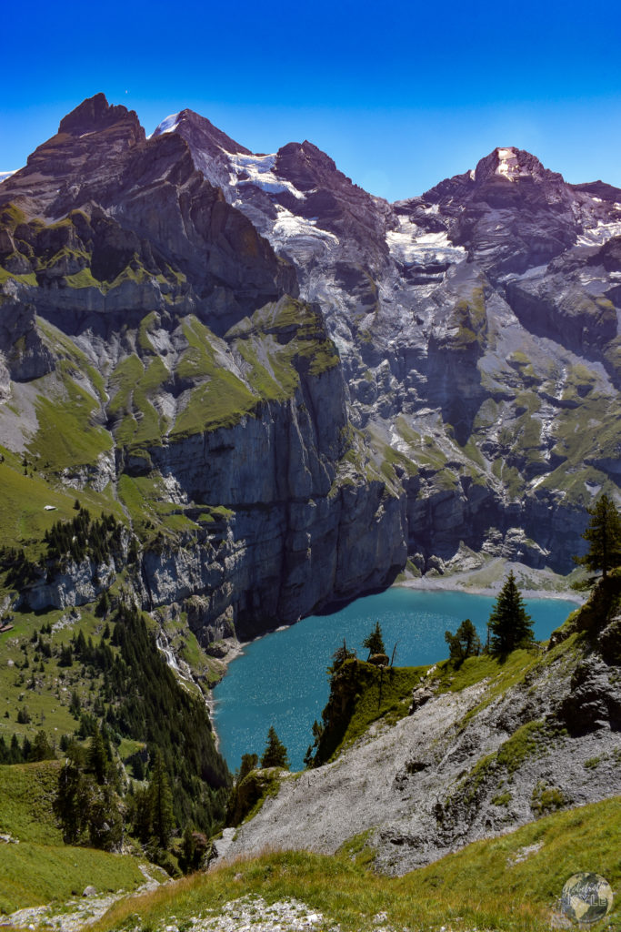
Oeschinen Lake, known as Oeschinensee Lake in Germany, is considered one of Switzerland’s most gorgeous lakes. Having now see this amazing landscape with my own eyes, I can confirm this lake’s reputation. Reviews of hiking Oeschinen Lake consistently highlight its mind-melting beauty: a grand turquoise lake surrounded by hundred-foot tall rock faces, dripping with over 20 hues of blue and gray that literally take your breath away.
Surprisingly, my first encounter with this landscape wasn’t a typical “oh my gosh, look how beautiful!” moment. Instead, about three miles into my hike, I crossed over a ridge and felt an overwhelming sense of nostalgia!
A Nostalgic Encounter
How do you have nostalgia of a place you’ve never been before? Let me explain…
Colorado has an amazing ridge in the southwest affectionately known as “The Swiss Alps of Colorado”. Located just outside Telluride, you can hike through the Sneffels mountain range and not be disappointed by a single view. If you ever get the chance, I highly recommend visiting the Blue Lakes area. Simply put: the environment is synonymous with jaw-dropping.
During COVID, when everyone was “teleworking”, I took a trip to Telluride to summit Mt. Sneffels, one of Colorado’s beautiful 14ers. The route took me through the Blue Lakes area, and I couldn’t believe how gorgeous it was, similar to reaching the view of Oeschinen Lake.
The deep blue skies peppered with fluffy clouds, the crystal clear, glass-like water, and the snow-dusted mountain backdrop made for the perfect setting. I’m confident that this location is where the Sneffels mountain range got its nickname for being the Swiss Alps of Colorado.
Starting the Hike to Oeschinen Lake
My bucketlist item was about to come true; it was time to go hiking Oeschinen Lake! My morning began at a trailhead near the Camping Rendezvous campground. I found this route using the “All Trails” app, which I highly recommend for finding hiking trails. However, just before I began, I remembered that I still hadn’t secured a spot to camp for the night.
So, I popped into the registration hut and asked the campground host if they had room for the night. They did, and I was pumped! This meant I could return and crash for the night after my hike.
Hiking Oeschinen Lake from Camping Rendezvous
My AllTrails app indicated hiking Oeschinen Lake would be about eight miles or five hours round trip. However, as I spoke with the campground host reserving my site, he gave me some intel on an even better route that was closer to ten miles and would likely take 7-8 hours.
He also mentioned something about having to hold on to a cable as I crossed a rock face suspended hundreds of meters over the water. I thought, “oh it won’t be that bad” so, I chose his route over the AlTrails route and pressed on.
The Uphill Battle
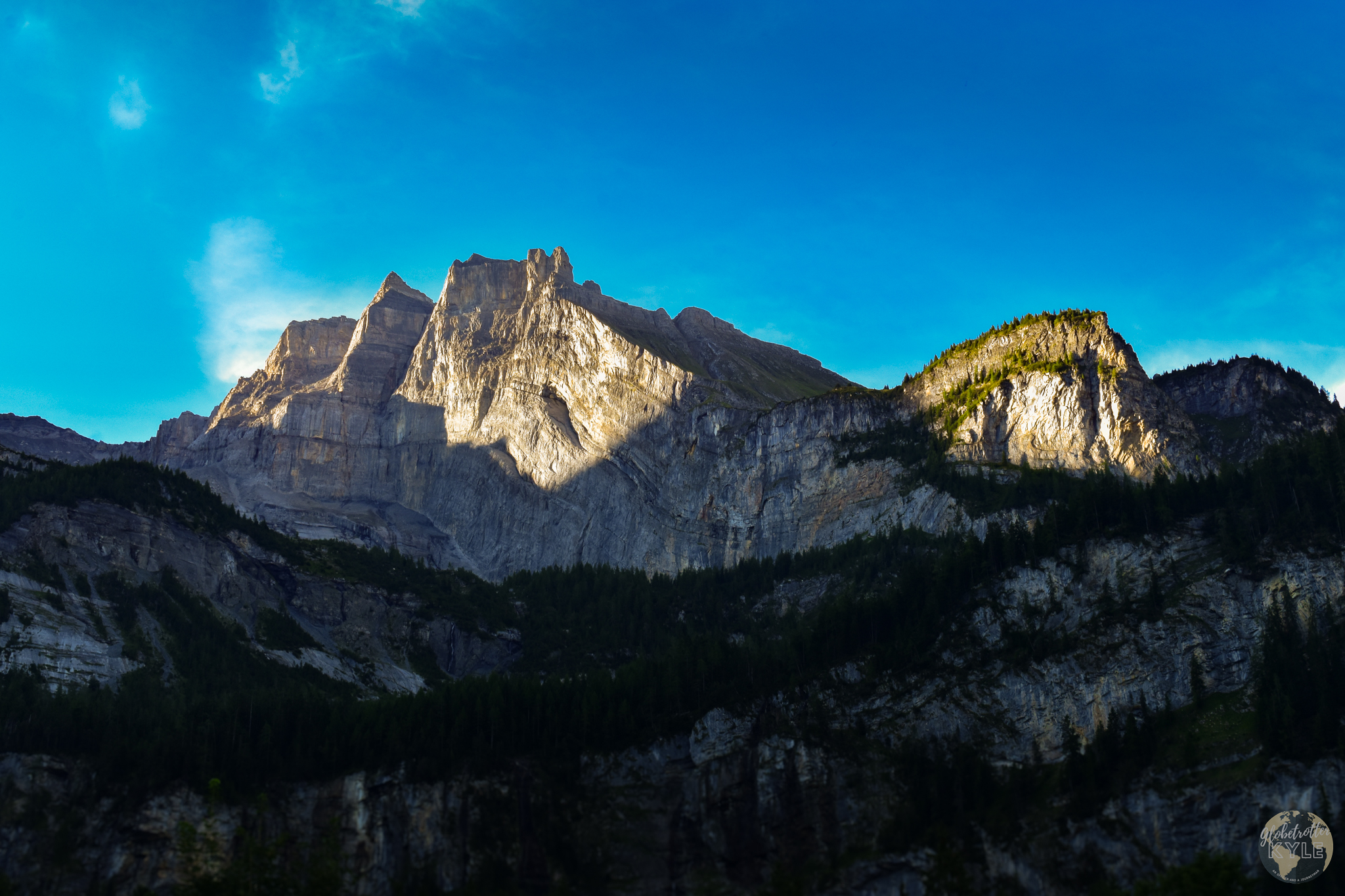
The first three miles of hiking Oeschinen Lake are an uphill battle to say the least. Up, up, UP I climbed, glad to have started early to avoid the heat. At the three-mile mark, my hard work was cerainly rewarded with an incredible view of Lake Oeschinen set beneath the towering cliffs of the Blüemlisalp massif on the east side of the lake. Hiking Oeschinen Lake was every bit I imagined.
Breathless from the incline and now the scenery, I took a moment to be still and take in my surroundings. What was once a photo on my Instagram feed was now God’s perfect design feeding my soul.
I could have sat there all day, taking photos and admiring the beauty and grandeur. But I was only three miles in on my hike of Oeschinen Lake! So, with a whole day of exploring left, I pressed on.
Traversing the Rock Face
Judging by the landscape, I could see I was at the highest point in the hike around Oeschinen Lake. Knowing that, I knew that the hard part was over and it was (literally) all downhill from here. However, I still had to traverse the massive rock face on the east side of the lake. This is what the campground host warned me about.
To give you an idea of what that looked like, check out the image below. See that horizontal crack half-way up? That’s the trail!
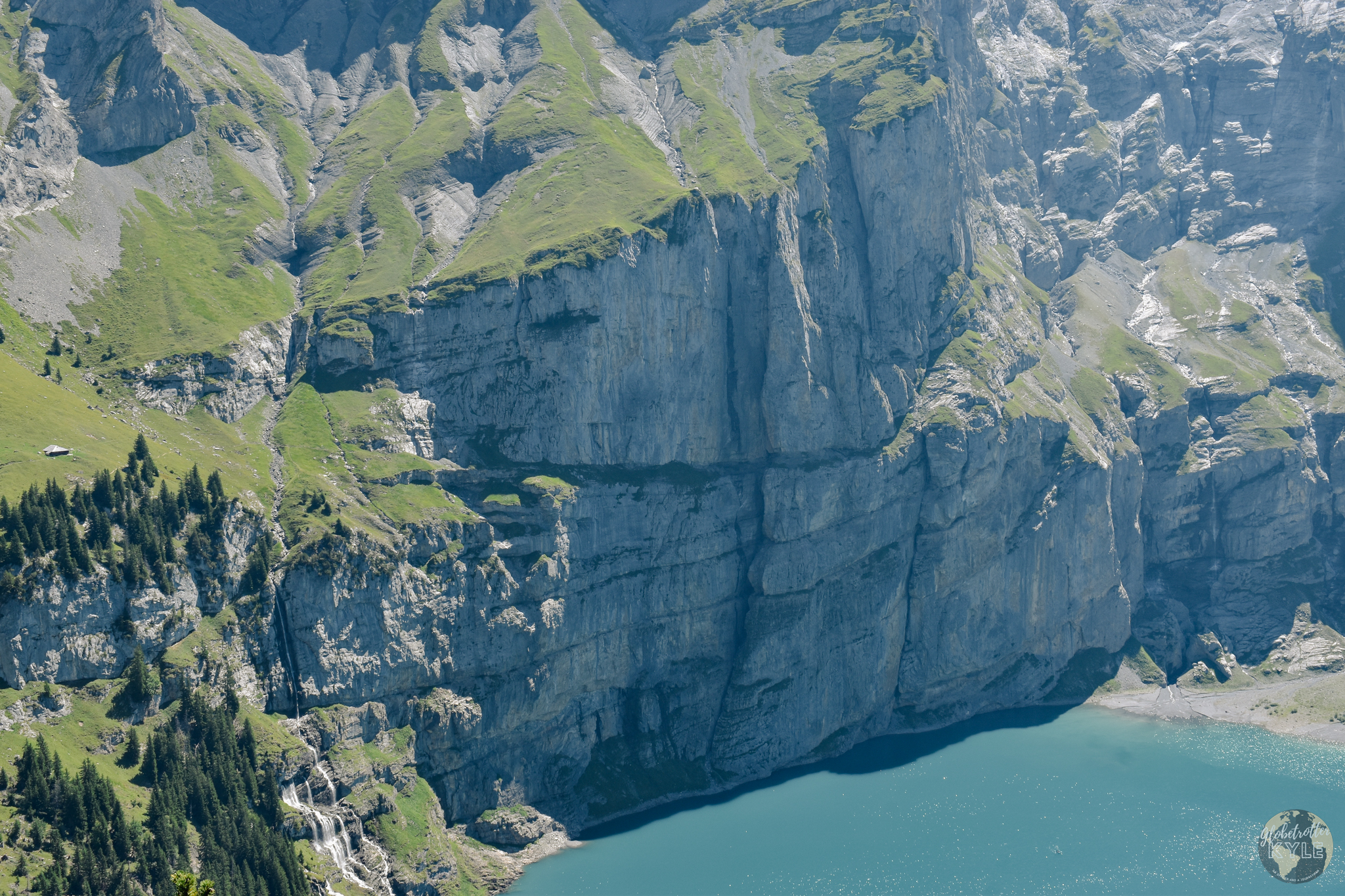
Needless to say, I was a tad nervous for that part. But, I didn’t have to cross that part for another few miles or so, so that was future Kyle’s problem.
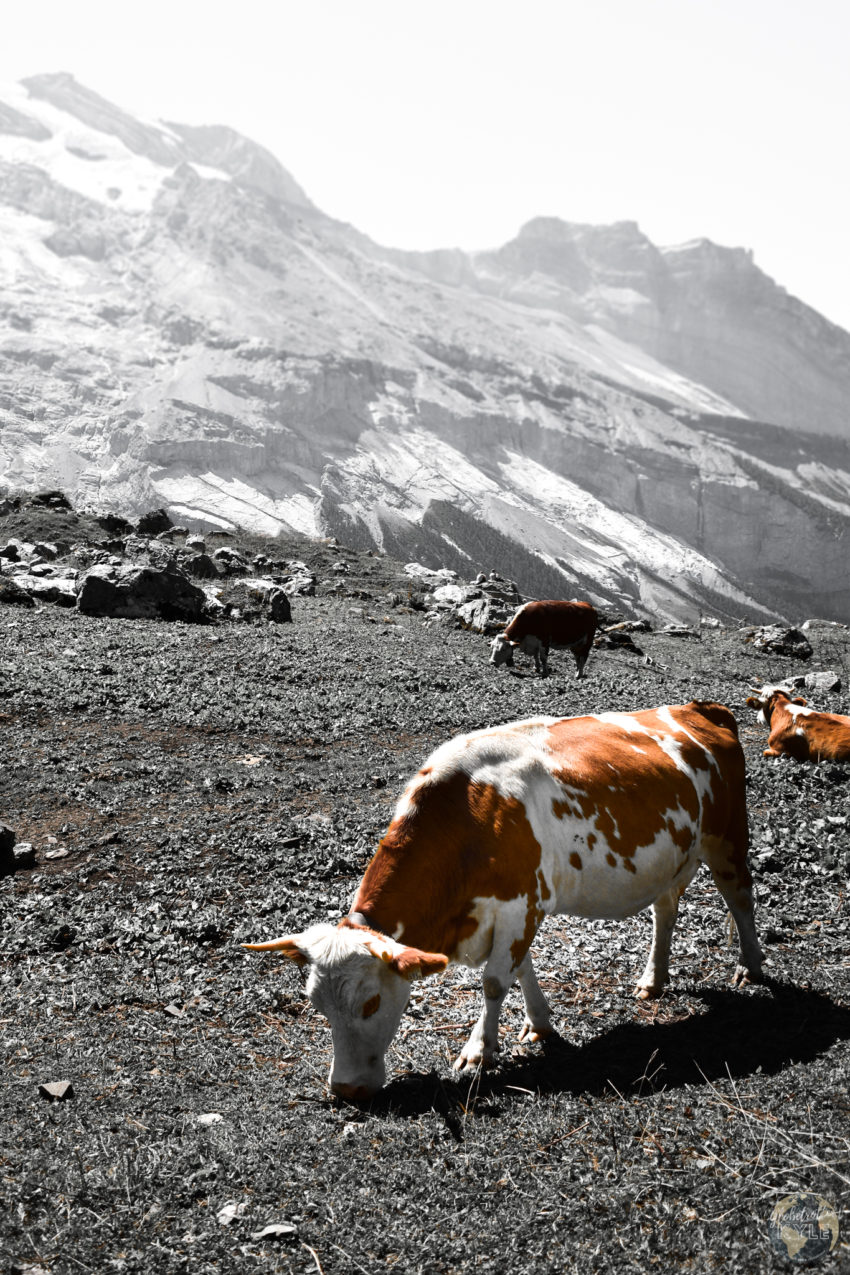
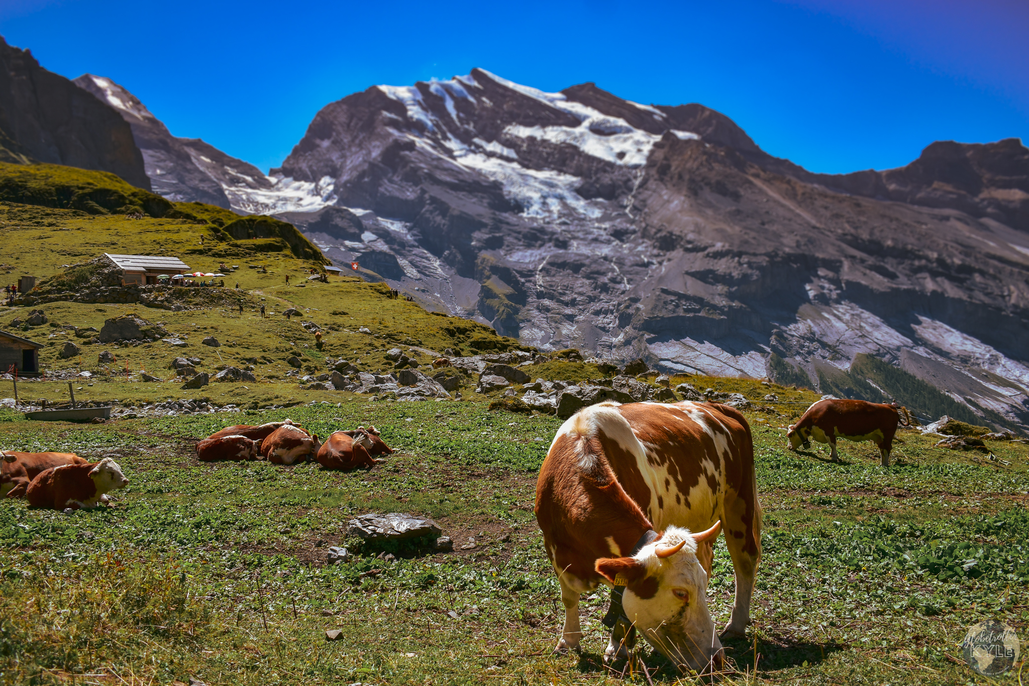
As I pressed on, I saw what looked like a bunch of umbrellas in the distance. Sure enough, as I got even closer, I saw a small hut and a large patio. To my surprise, this little hut had a name: the Berghaus Unterbärgli. Also to my surprise, the hut sold beer! Hiking Oeschinen Lake is definitely a tad more luxerious than anything I hiked in the rugged Rocky Mountains. Naturally, I took a load off, enjoyed the sights, and indulged in a German bier.

The best part wasn’t the beer or the scenery; it was the company! At nearly 6,500 feet above sea level, I was joined by a dozen or so happy cows.
While I rested my tired legs, they grazed up and down this Swiss mountain, ringing their cowbells with each bite. They might not have known it but, to me, they were filling the air with a beautiful bell choir. It was a sureal experience!
Facing the Heights
Pressing on, I knew I had about six more miles before I’d make it back to camp. It was time to cross the rockface and get to the other side.
As the trail got narrower, I nearly had a heart attack when I heard something charging right at me! I must have spooked something because as I turned my head, I saw horns fleeting from me.
It was a three Alpine ibexs! They were running from me down a grassy landing and towards the lake. Being from Colorado, you usually encounter deer along hikes, but these things were much larger!
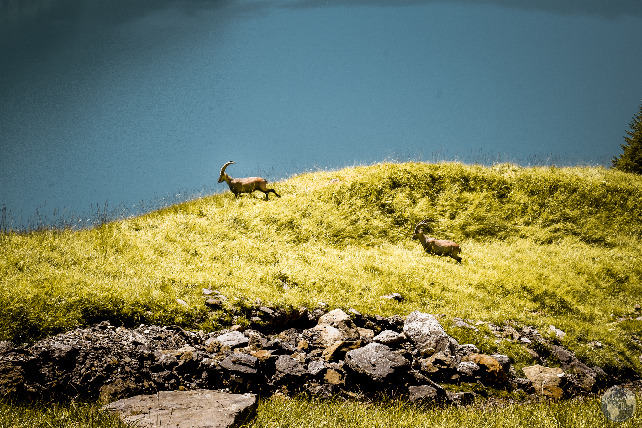
Trying to capture a good photo of these majestic creatures, I realized just how fast these guys are! I barely got one or two shots with my camera before they disappeared over the grassy ridge. I was so worried that they had just plunged to their death! However, as I pressed on, the next thing I knew they were above me! These agile creatures sure make hiking Oeschinen Lake seem like a breeze.
Now, when the kind campground host told me that the route was going to be a “fun” loop, he didn’t say that it was going to require a serious comfortability with heights. As I clung to the steel cable fastened to the rock face, I kept telling myself two things: don’t slip, and don’t look down. The fall alone would’ve lasted at least 6 or so seconds before I’d either die on impact, or die from a heart attack.
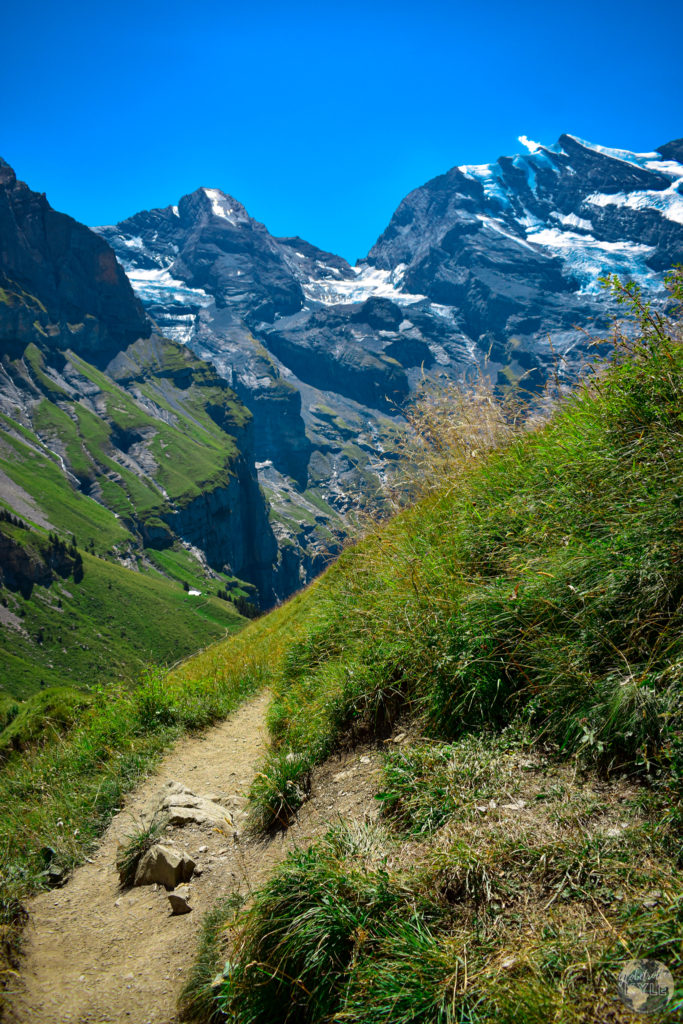
Headed back down
Once safely across the rock face, I took a second to assess the route down and pressed on. From here, all I had to do was stick to the trail and I’d be at the lake in no time. Tired, sweaty, and in serious need of some food, I had one last thing to do before I could consider Hiking Oeschinen Lake complete: jump in the lake of course!
Safely off the mountain and on the beach, I was finally done with my hike of Oeschinen Lake. It was incredible to say the least. Longing to get into the water, I ducked behind a tree to strip down and change into swim trunks. I don’t usually hike with swim trunks, but after seeing that swimming in alpine lakes is acceptable in Europe, I have since carried them with me on every hike lol.
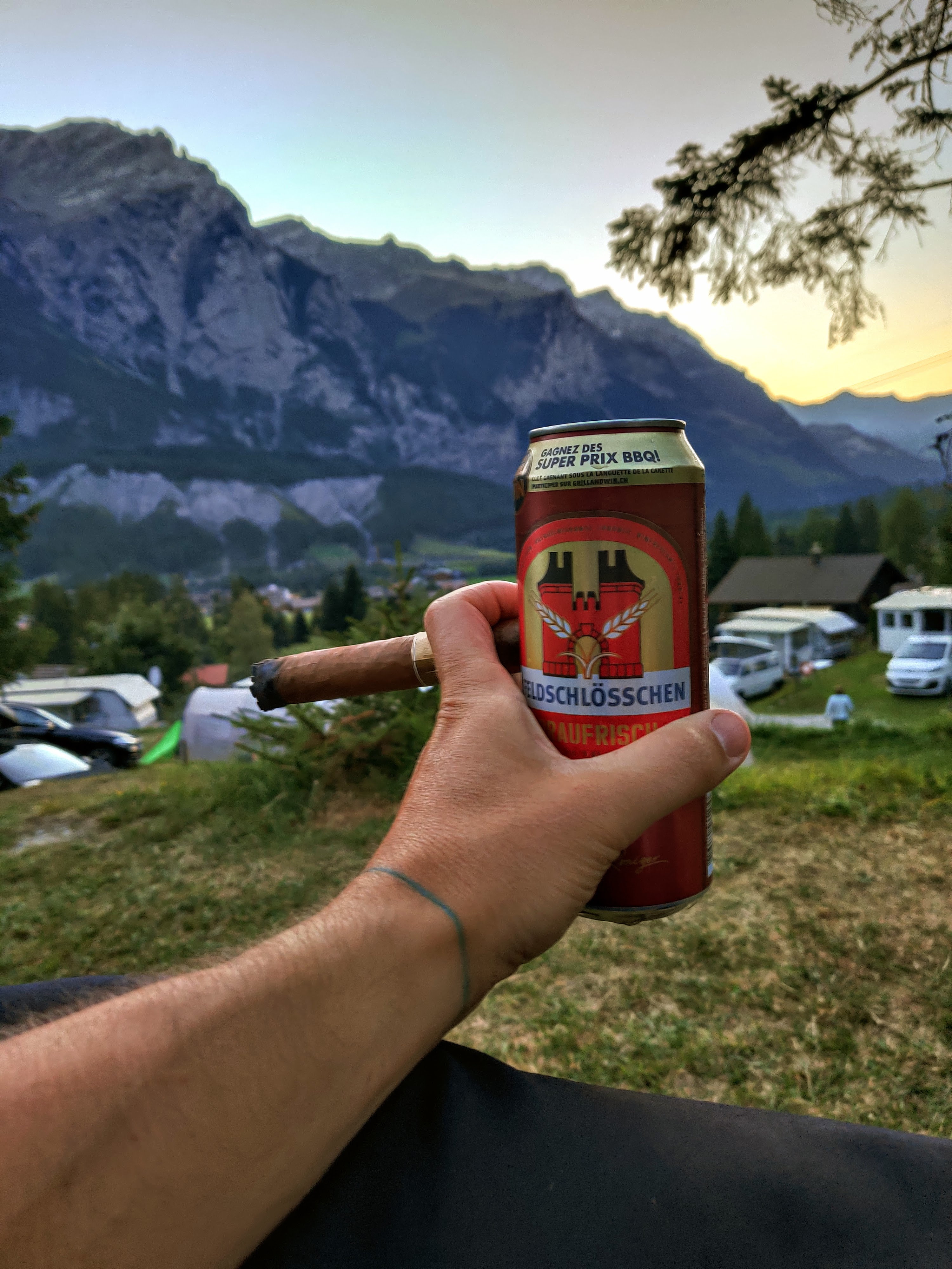
The icy water was the perfect way to cool off after such a strenuous hike. The crystal clear water and blue skies above were an amazing combo I didn’t know I needed. Having successfully cooled off, I exited the lake and changed into some dry clothes. All that was left was to head back to Camping Rendezvous, eat some dinner, drink some beer, smoke a cigar, and reminisce on my amazing journey. So, that’s exactly what I did!
A Perfect Ending
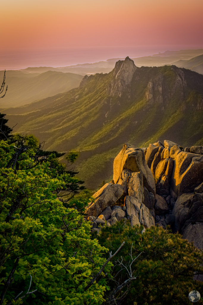
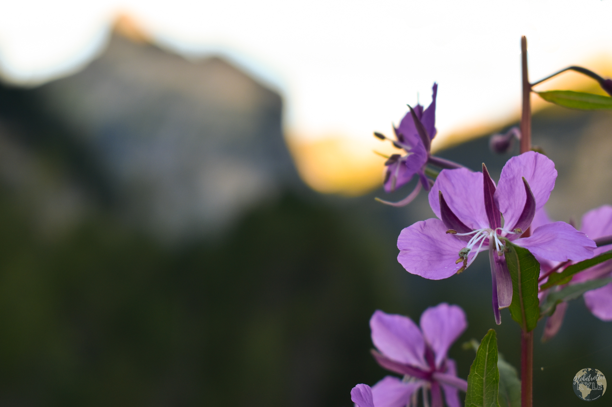
Blessed to be finishing the hike around golden hour, I caught sight of God’s incredible creation once more before reaching camp. Dotting the river banks along the final trail down were these small, purple flowers. I must have missed them on my ascent, probably because I was too busy soaking in the mighty mountain peaks all around me. Nonetheless, I was definitely noticing them now.
As the sun set behind me and the day began to retire, I took a few photos before giving thanks. I said a little prayer thanking God for the blessings He gave me so that I could be fortunate enough to experience such a wonderful day.
Then, with a full heart and a tired set of legs, I propped myself up in my $5 camping chair and smoked a fat, Cuban cigar while enjoying a frosty beverage. A perfect ending to a perfect day, totaling 12.36 miles, and lasting just over 8 hours.
FAQs about Oeschinen Lake
Where is Oeschinen Lake?
Oeschinen Lake is located in Berne, Switzerland. Berne is like the “state” within Switzerland, and the lake is located in the highest and southernmost part of Berne towards the “center” of the country.
How to reach Oeschinen Lake? How do you get to Oeschinen Lake
By public transit: take a train to Interlaken, then from Interlaken, take the bus to Kandersteg, the town where the trailhead is located.
By car: From Stuttgart, it’s 4 hours 45 minutes (round up to 5 hours for a pit stop). Type in Oeschinen Lake in your GPS and follow instructions.
Be sure to stop at the Swiss border crossing and pay ~$40 for the highway pass! If not, you’ll still be allowed to drive in Switzerland, you just won’t be able to take any of their highways. This will add at least 2 extra hours on to your trip.
How do you get to Oeschinen Lake from Interlaken?
By car: Drive about an hour to Kanderseg and then park at 46.495420, 7.679270. You’ll find a pay station and you can pay with your phone to park in this lot.
I recommend downloading the Easy Park app. You can set it up in no time, it’s extremely user friendly, and it’s generally accepted all over Europe. Plus, if you’re running out of time, you can “dial” in more time on you phone from anywhere!
By bus: Take bus number 60 headed towards Spiez (about 30 minutes). From there take the regional bus (likely called RE 4263, 4xxx, etc.) for 4 stops, about 30 minutes, to Kandersteg for 20 euro. From Kandersteg, make your way east to Camping Rendezvous where you can hit the trailhead and start the hike!
What to do at Oeschinen Lake?
- Go hiking. Explore the various trails around the lake. For my epic route, read the story above!
- Swim in the lake. Take a dip in the clear, glacier-fed waters! Be careful though, the water is primarily glacier-fed, so it can get a bit chilly!
- Rent a boat. Rent a boat and paddle around the lake. There’s an equipment rental facility at the edge of the lake that will let you rent boats an such; go paddle out to the middle maybe!
- View the waterfalls. Visit the waterfalls on the east end of the lake. Either rent a boat and go see them or hike to the opposite side.
- Ride the gondola up. Don’t feel like hiking all the way up to the lake but, still want to experience some of the best views in all of Switzerland? Well, for ~30 euro, you can have a gondola take you all the way to the banks of the lake! Take a gondola for stunning views without the hike, and visit their official website for more details.
- Have dinner with a view. There’s a restaurant about 100 feet from the water’s edge; go have a beer and take in the views!
- Go fishing. Try your luck fishing from the shore or a rented boat. I saw numerous fishermen trying to snag their daily limit; give it a shot yourself!
When is the best time to visit Oeschinen Lake?
For hiking, visit just before or after summer to avoid the crowds and the heat. Mid-August is ideal for avoiding snowy patches.
Can you drive to Oeschinen Lake?
Short answer: no. However, you can drive to the Oeschinen Lake gondola parking lot where you can take a cable car directly to the lake,
Can you swim in Oeschinen Lake?
Yes, swimming is allowed. The water is cold but refreshing!
Does Oeschinen Lake have a Cable Car? How long is the gondola ride to Oeschinen Lake?
Yes! The ride takes about 6-7 minutes; find more info at their website, here.
Can you camp at Oeschinen Lake?
Short answer: no.
With that said, there are still opportunities to camp near Oeschinen Lake, such as at Camping Rendezvous (where I stayed during my journey). Additionally, if you’re looking to backpack into the area, I recommend staying at the Fründenhütte. This mountain hut is found high above Oeschinen Lake. You’ll want to follow the trail I took but once across the rock face, continue up to the mountain’s ridge. I saw quite a few people heading that direction when I hiked Oeschinen Lake. Had I had a few more days (and better gear), I would’ve happily joined them!
Can you fish in Oeschinen Lake?
Yes! On my hike, I saw plenty of fisherman fishing from the shore and from the rental canoes/kayaks. Read more details on their official website.
Does Oeschinen Lake have a restaurant?
Yes! However, it’s attached to a hotel that sits along the shores of the lake, so you might have to compete with the hotel guests to get a seat. Don’t hesitate to check their website for more details!
What’s the best hiking trail at Oeschinen Lake?
Hands down one of the best hikes you can do starts at Camping Rendezvous and takes you all the way around the lake. Don’t believe me? Read my post above for my epic adventure doing just that! just under 12.5 miles and 8 hours, this trip is not one for the faint of heart (or heights!) but is perfect for the adventure seeker 🙂